July 28, 2020 - Flyby New York City w/ Maggie
|
|
My daughter Maggie was in town so I took her flying on a hot summer day. The plan was to get breakfast at Cape May -- one of the few airport restaurants open today -- and then show Maggie New York City from the air, flying the Hudson River corridor.
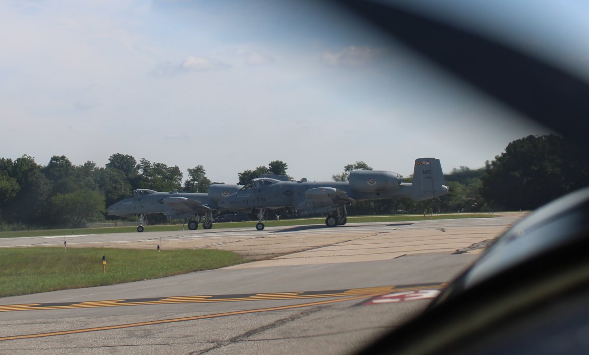
Here we are waiting for two Maryland Air National Guard A-10s to take off at Martin State Airport.
|
| |
 |
|
|
We transited to Cape May up at 5,500 feet where the air was cool and smooth.
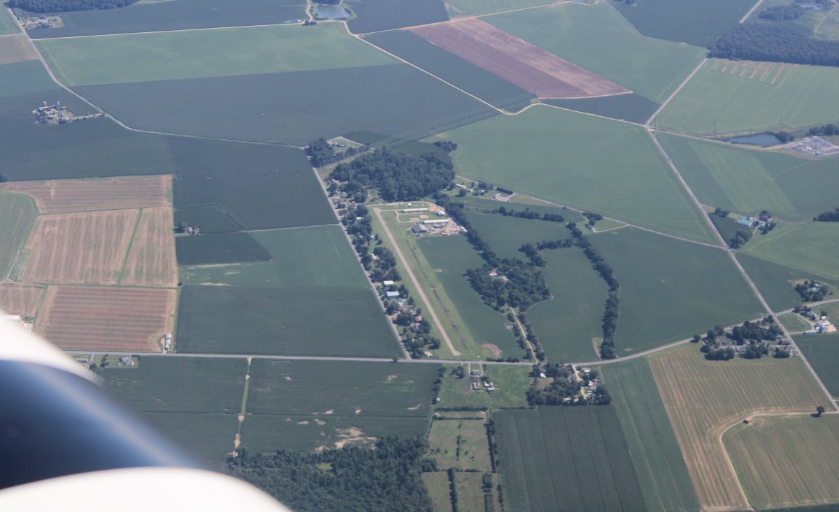
Looking down at Chandelle Estates Airport (0N4) which is a little airport community just north of Dover Air Force Base. I landed at Chandelle once in the Citabria.
|
| |
 |
|
| On the ramp at Cape May Airport where we enjoyed a nice breakfast. |
| |
 |
|
|
Departing Cape May, we climbed up to 5,500 again and headed north northeast up the Jersey Shore. Normally I would fly the shore down low at 500 feet but it was just too hot today.
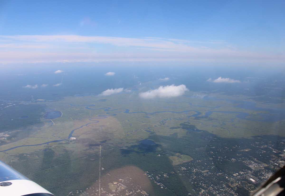
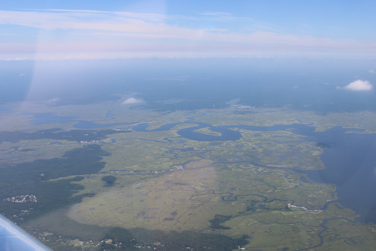
Looking down at the big Tuckahoe - Corbin marsh area west of Ocean City, NJ. Speaking of which, Ocean City, NJ has an airport which has an airport restaurant. But last night I checked and discovered it had gone out of business shortly after the Chinese Virus lockdowns started in March. It's always sad when an airport restaurant closes.
|
| |
 |
|
| The first time I've seen Atlantic City International Airport from the air. We flew over their Class C airspace. |
| |
 |
|
| Approaching the Mullica River and Port Republic marsh area, just west of the Great Bay area. |
| |
 |
|
| Looking down at Eagles Nest Airport (31E). |
| |
 |
|
|
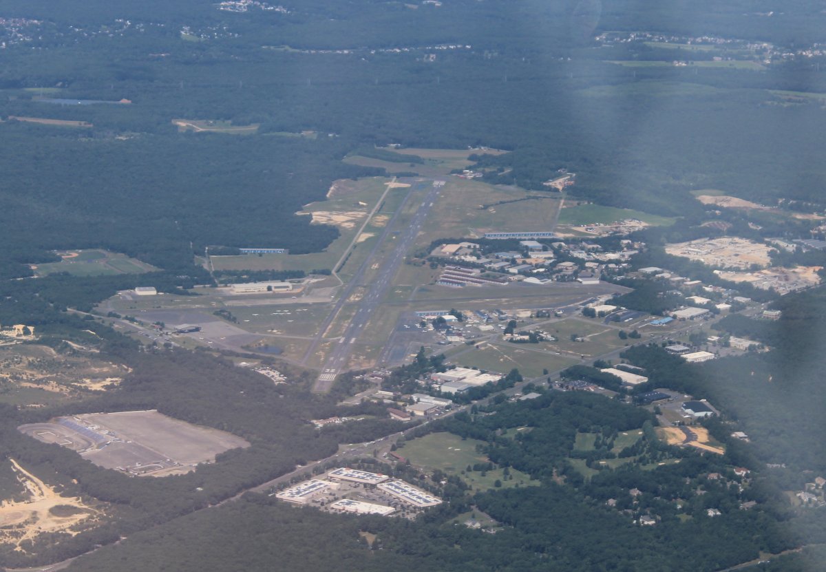
Looking down at Monmouth Executive Airport. Back in 2004 I landed here once in the Citabria for a business trip of all things.
|
| |
 |
|
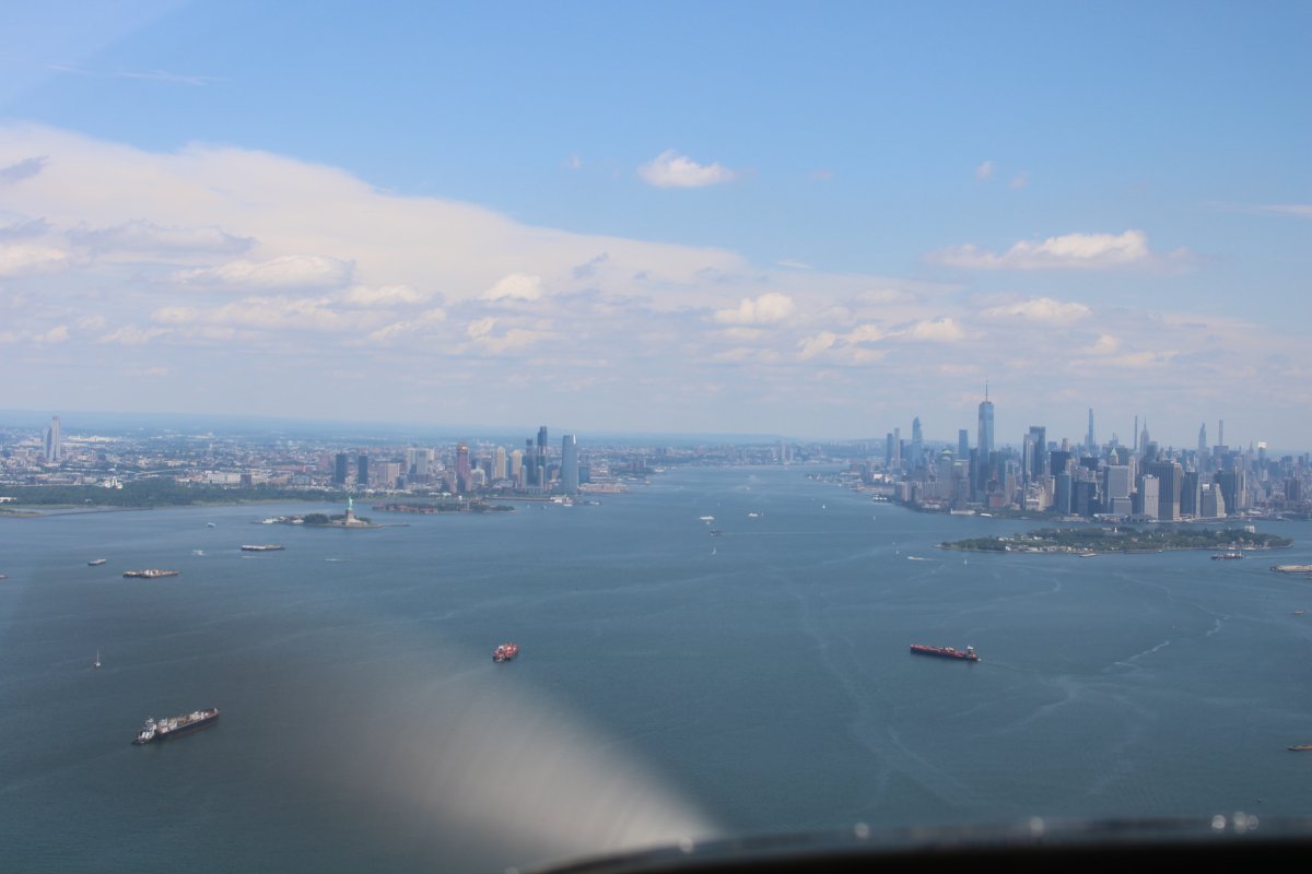
| We descended down to 1,100 feet to get under the New York airspace, crossed over the Verrazano Bridge, and are now cruising over the Upper Bay. The entrance to the Hudson River is dead ahead. |
| |
 |
|
|
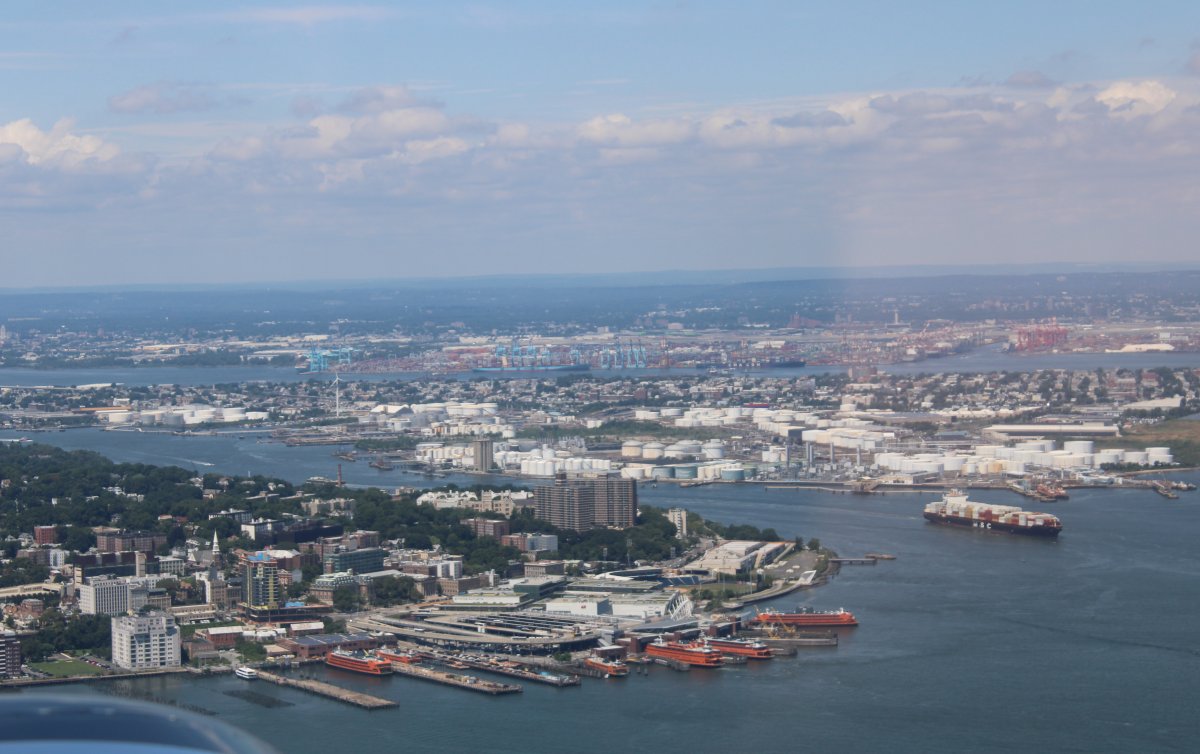
Looking at St. George, NY on the left, Constable Hook, NJ on the right, with Port Newark and Newark Liberty International Airport in bha background.
|
| |
 |
|
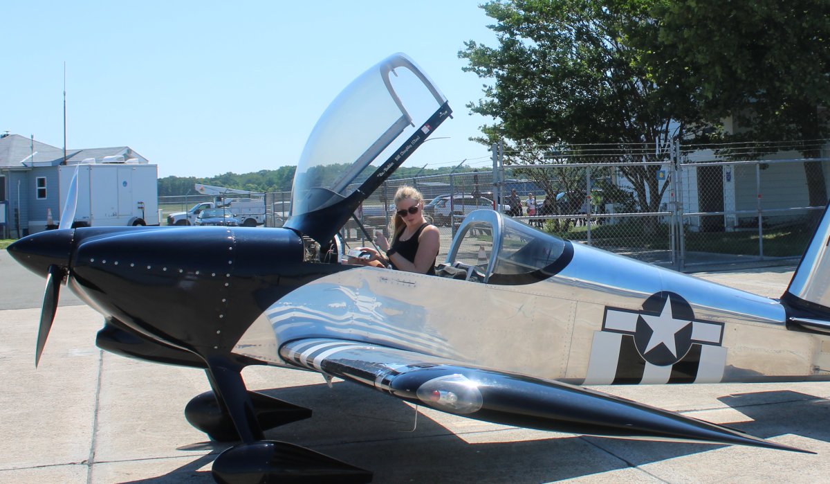
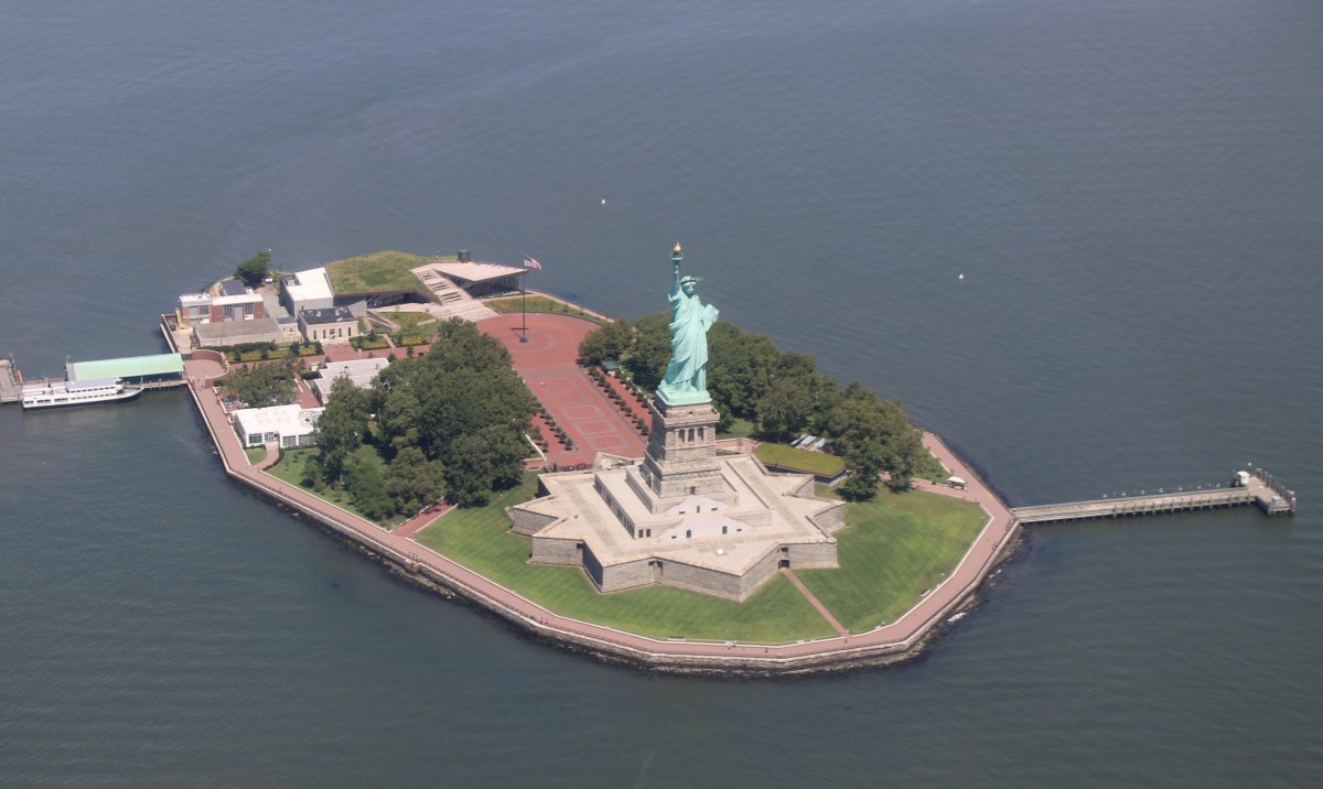
| A lady who needs no introduction. |
| |
 |
|
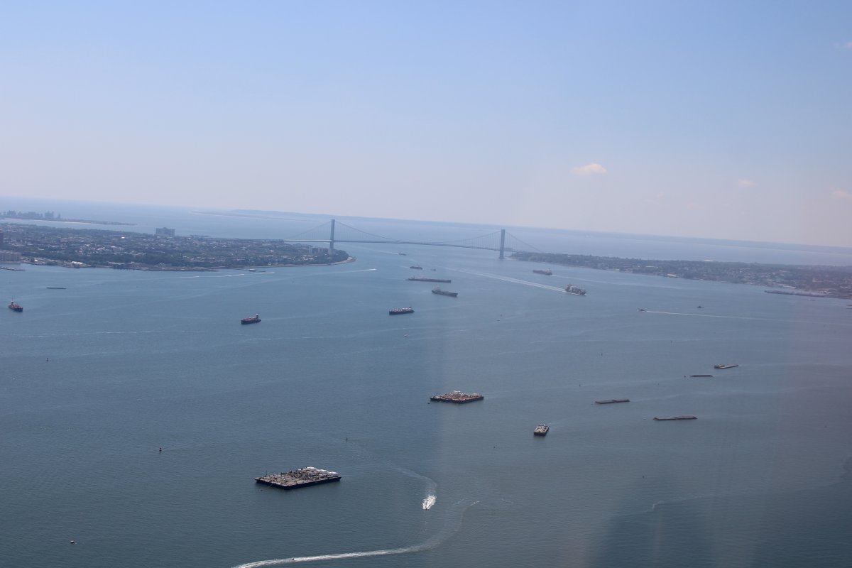
| Looking back at the Verrazanno Bridge and the Lower Bay. |
| |
 |
|
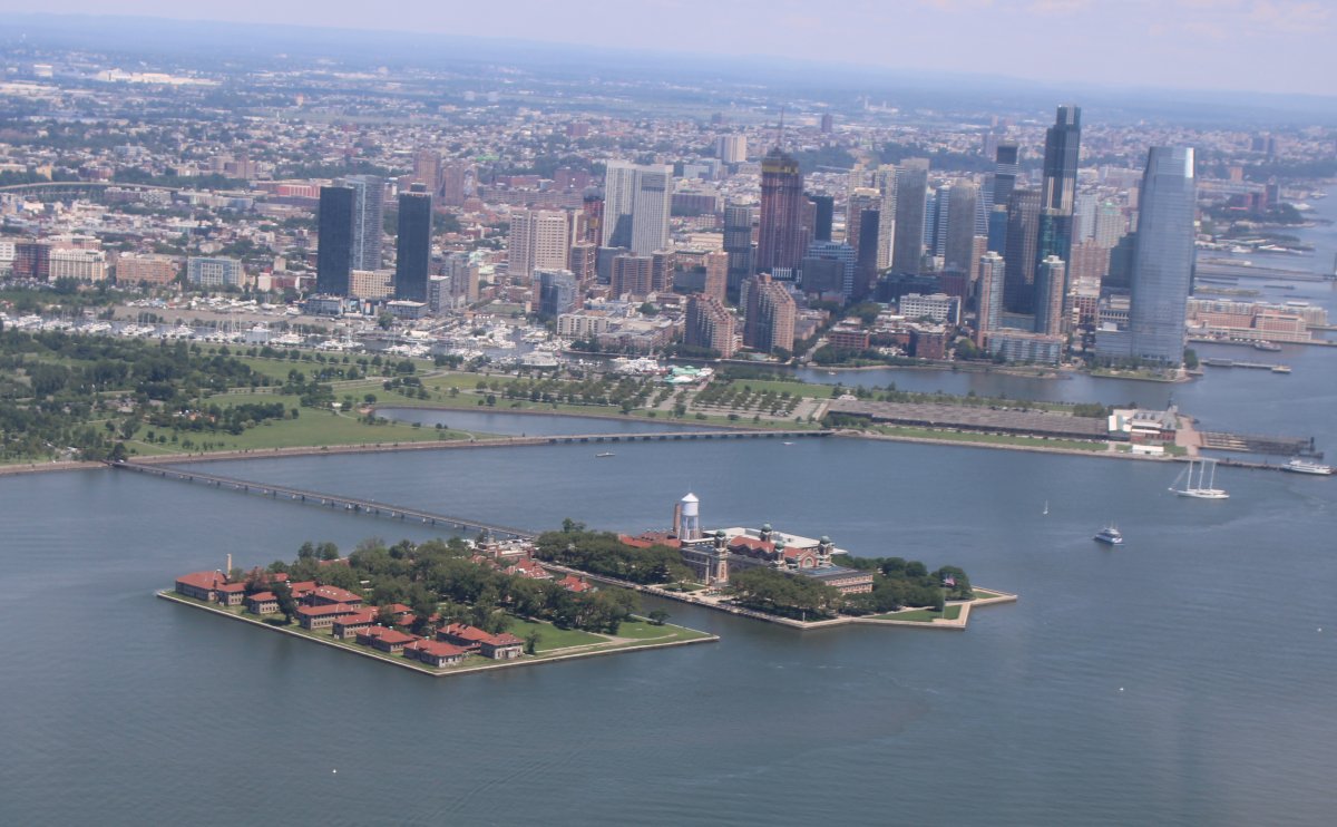
| Ellis Island |
| |
 |
|
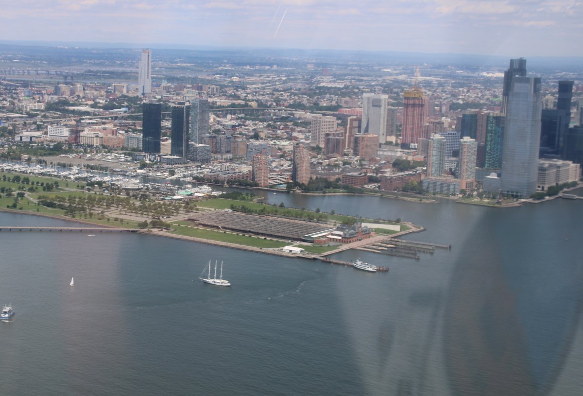
At center is the Central Railroad of New Jersey Terminal. It's also known as Communipaw Terminal. Communipaw means big landing place at the side of a river in the Lenape language. The terminal was built in 1889 and was one of five passenger railroad terminals that lined the Hudson Waterfront during the 19th and 20th centuries. It operated until 1967. In the 1970's, the terminal building was renovated and incorporated into Liberty State Park. |
| |
 |
|
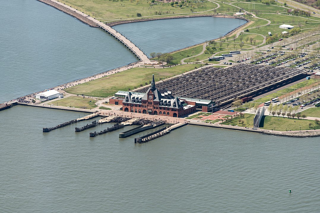
A closer look at the Central Railroad of New Jersey Terminal courtesy of Fletcher from Wikipedia. In front of the terminal are the Ferry slips. Behind the terminal building are the abandoned train sheds which covered 12 platforms and 20 tracks. |
| |
 |
|
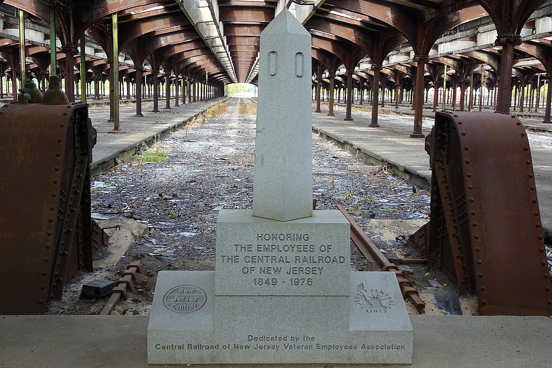
| A good look at the inside of the train shed, courtesy of Zeete from Wikipedia. |
| |
 |
|
|
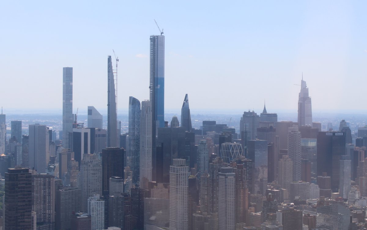
It seems to me that New York City has a bunch of very tall skyscrappers I don't remember seeing in the past. I noticed at least three taller than the Empire State Building in upper Manhattan, seen here on the right. So I took a bunch of skyline pictures and googled "tallest skyscrapers in NYC". Of course, a Wikipedia entry "List of tallest buildings in New York City" popped right up. Some are still under construction.
The Empire State Building may not be as tall, but it is certainly wider and more solid-looking.
|
| |
 |
|
|
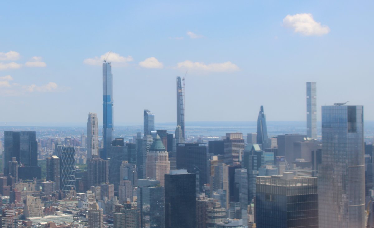
That tall one on the left is the Central Park Tower. The slender one in the middle is 111 W. 57th Street. And the tall one on the right is 432 Park Avenue.
|
| |
 |
|
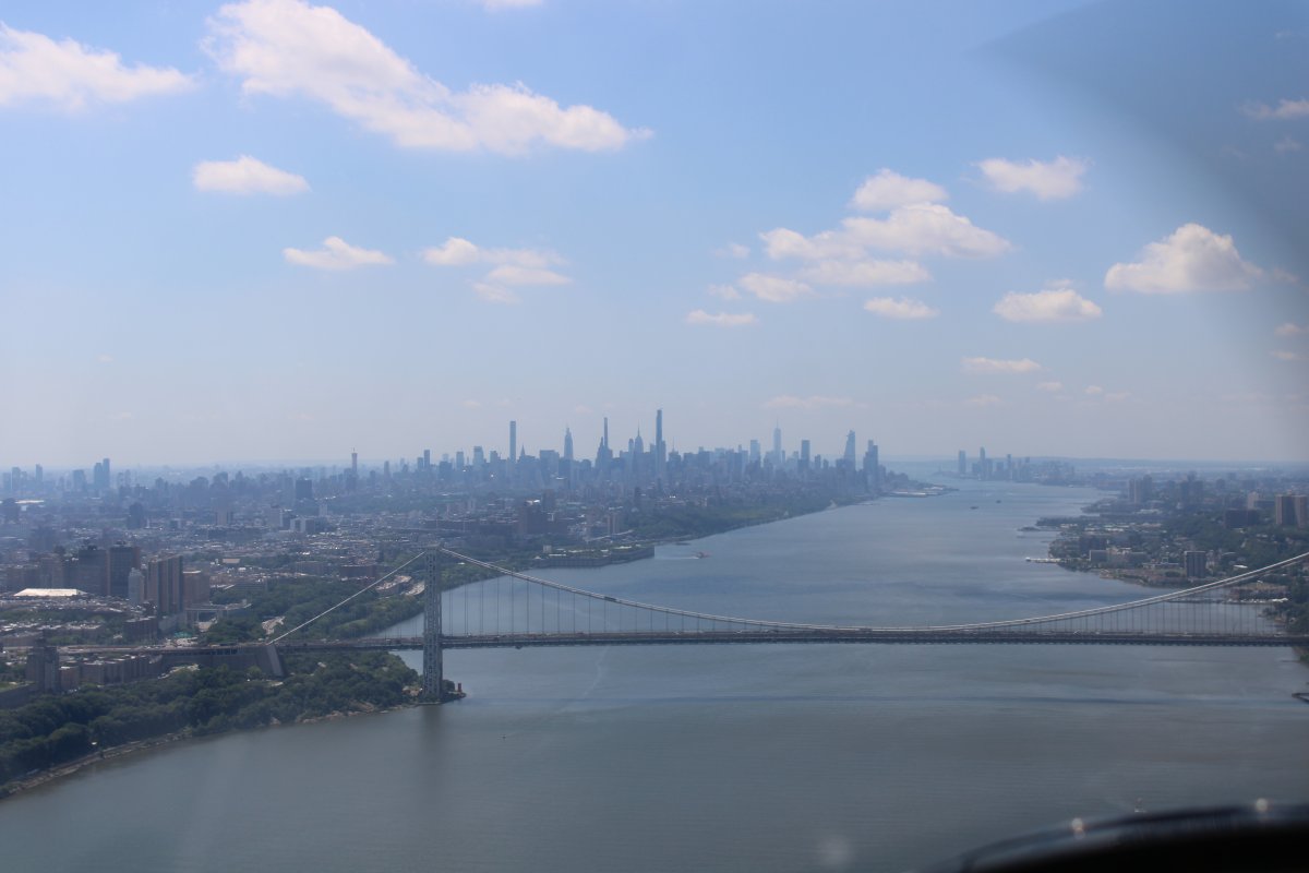
| We passed over the George Washington Bridge, flew a mile or so and made a U-turn over the Hudson River. I was making my position reports on the unicom frequency but I was the only one. Airborne traffic was very light. Even the tour helicopters were not out today. |
| |
 |
|
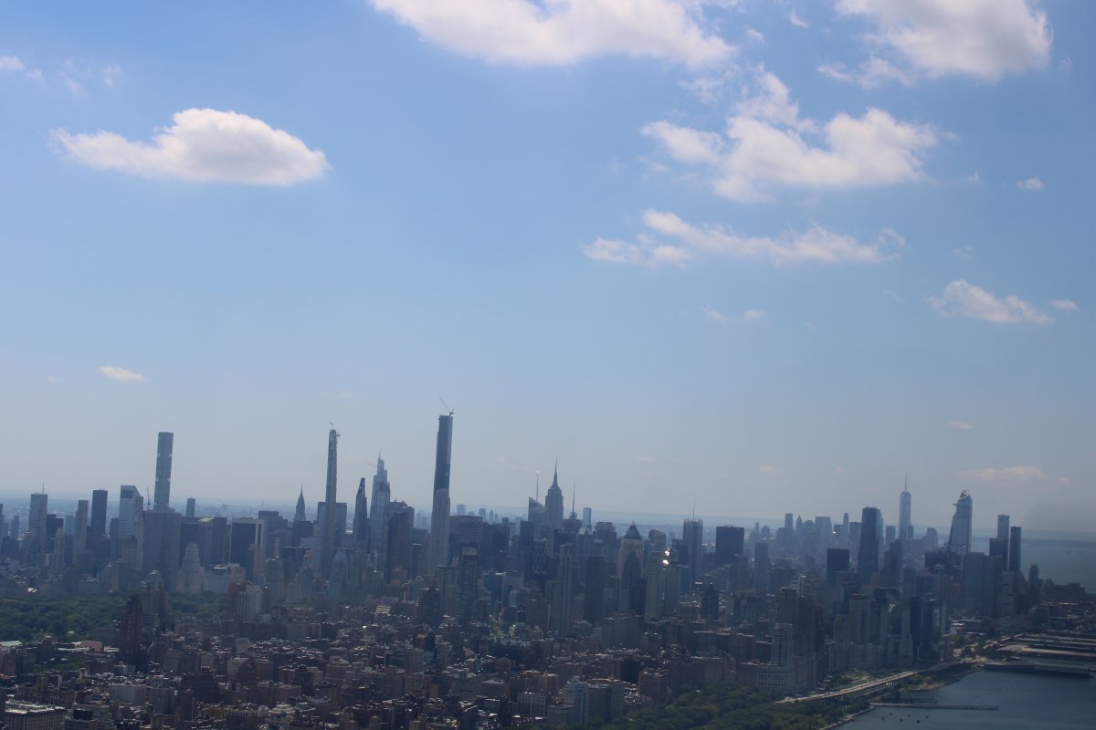
| Heading south. The Empire State Building at center looks small compared to the new skyscrappers. At 1,250 feet tall, it will only be the 7th highest in NYC. |
| |
 |
|
|
A good look at the Central Park Tower, also known as the Nordstrom Tower, in the center. At 1,550 feet, it has the highest roof height of any building in the United States. The building is also the tallest residential building in the world both by roof height and architectural height. It should be completed in 2020. It is the second highest in NYC.
To the left of the Central Park Tower is 111 West 57th Street, also known as the Steinway Tower. At 1,428 feet, it is the world's most slender skyscraper. It is also third highest in NYC.
To the left of the slender Steinway Tower is 432 Park Avenue which tops out at 1,396 ft. It will be 5th highest in NYC.
To the right of Central Park Tower I believe is One Vanderbilt which when completed in 2021 will be 4th highest in NYC at 1,401 feet.
|
| |
 |
|
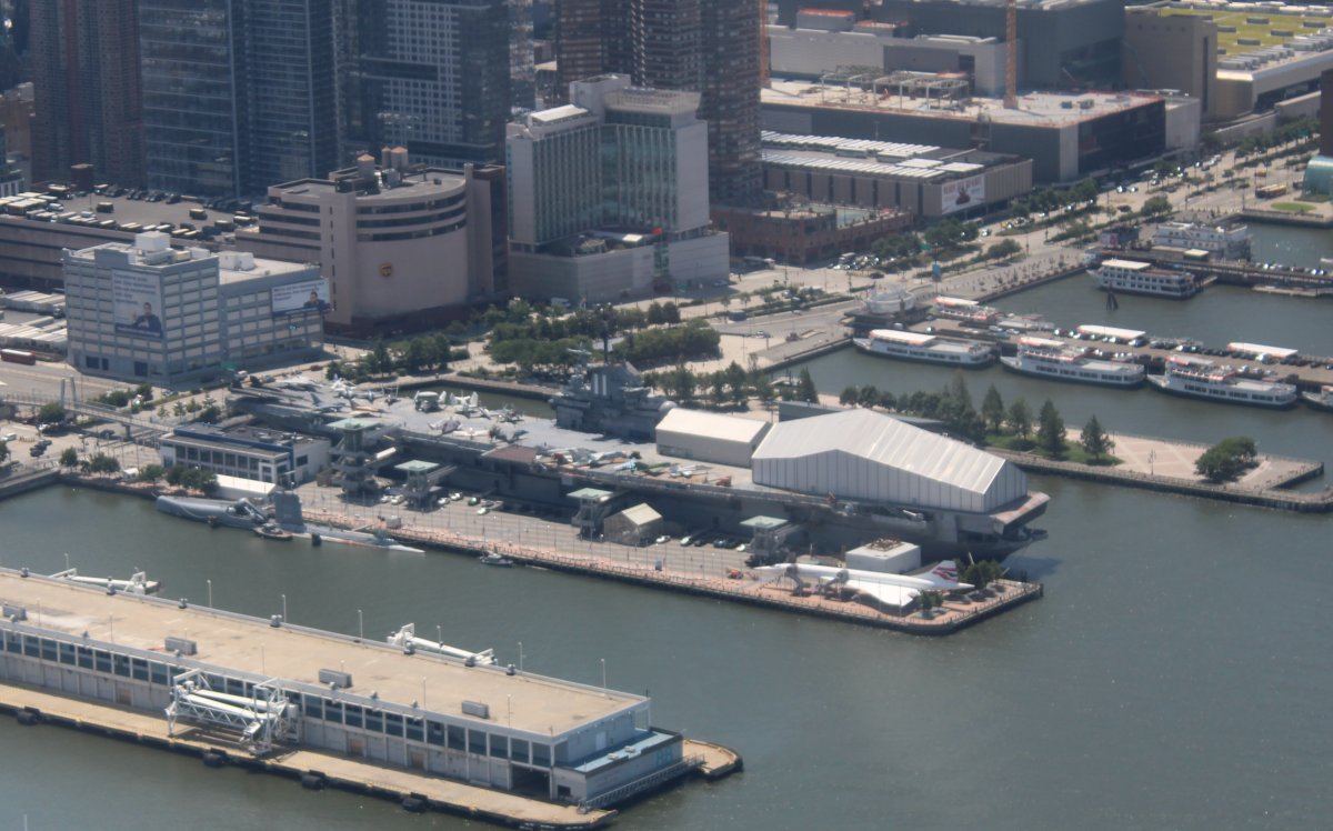
Passing by one of the reporting points. USS Intrepid, the World War II aircraft carrier. I had wondered what that big white building on the flight deck is but I finally realized it must be for the Space Shuttle Enterprise. The Intrepid -- CV-11 -- one of the earliest of the 24 Essex-class fleet carriers -- was commissioned in August 1943, and participated in all the campaigns in the U.S. Navy's march across the Central Pacific to Japan. She served after the war all the way to 1974. |
| |
 |
|
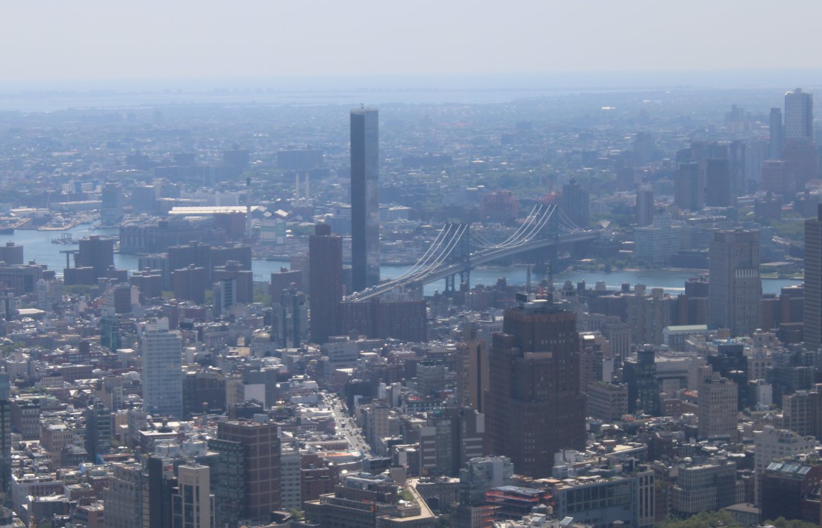
Looking across lower Manhattan at the Williamsburg Bridge crossing the East River into Williamsburg (and Brooklyn). The Brooklyn Navy Yard -- established in 1801 and used from the early 1810s through the 1960s -- is just out of site on the other side of the East River to the right. |
| |
 |
|
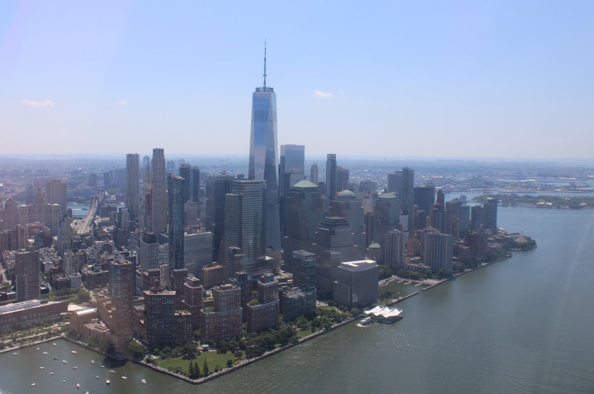
| The One World Trade Center, or Freedom Tower, dominates lower Manhattan. It is the tallest building in the western hemisphere -- and NYC -- by architectural height (whatever that means) and sixth tallest in the world. |
| |
 |
|
|
We departed the way we had come, over the Verrazzano Bridge, and down the Jersey Shore. We flew at 500 feet down the shore for awhile but it was too hot and bumpy so we climbed for cooler and smoother air and turned inland towards Baltimore.
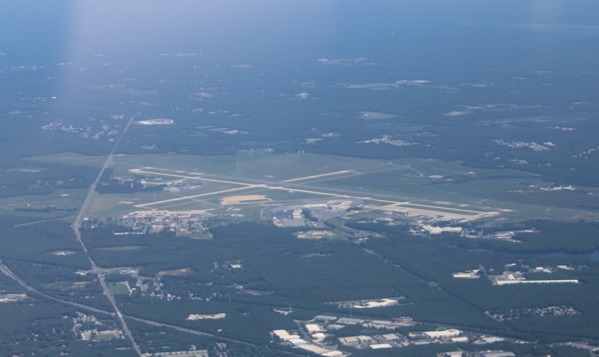
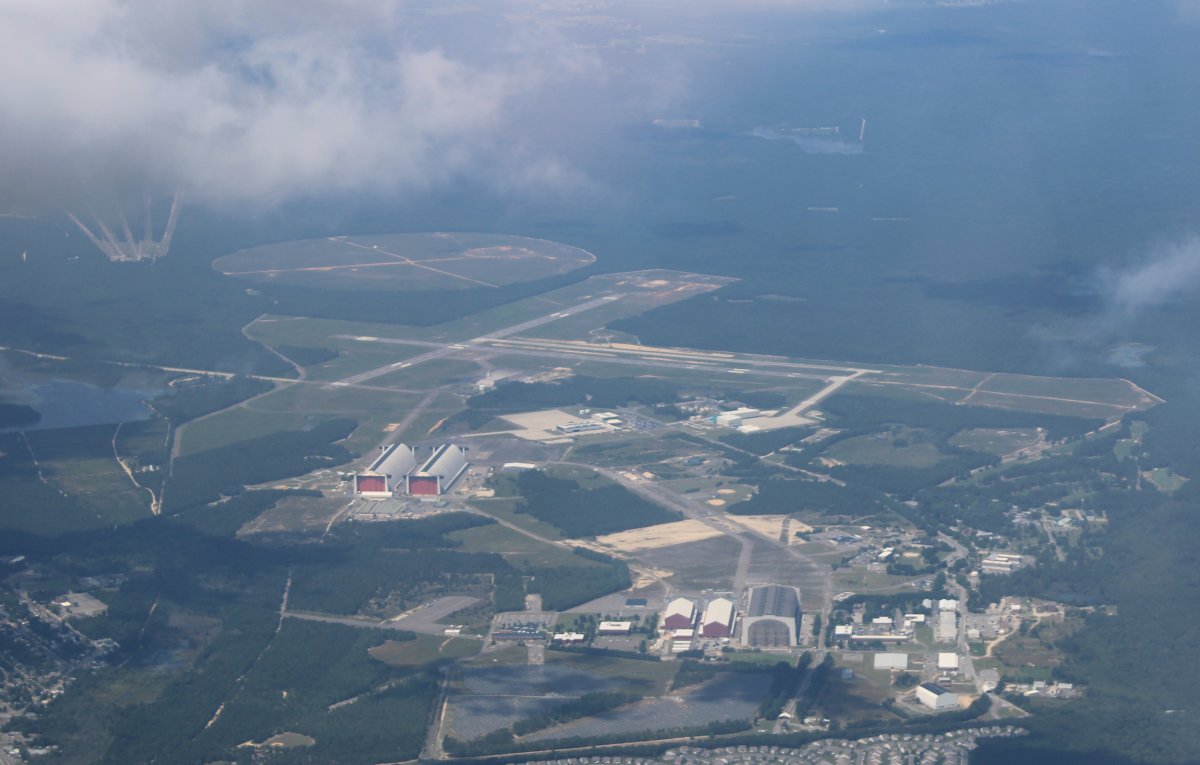
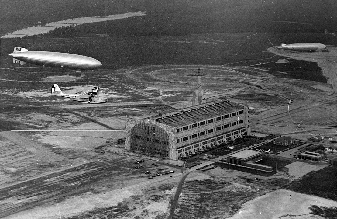
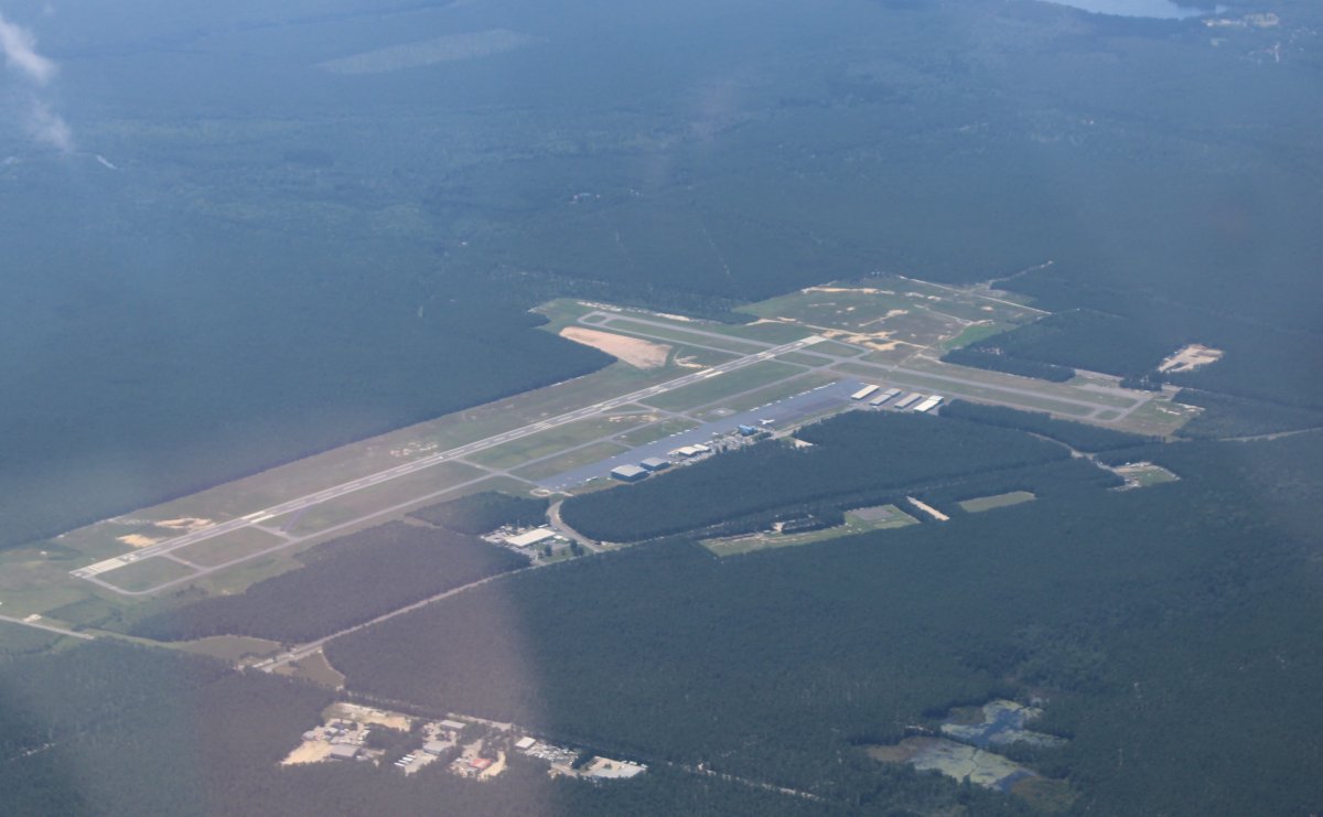
Here we are passing by Lakehurst Maxfield Field Airport. Notice the two big blimp hangars at lower left. The big Hangar One that housed the rigid airships can be seen at lower right.
This area used to be known as Naval Air Station Lakehurst. It was the center of airship development in the United States and housed three of the U.S. Navy's four rigid airships: Shenandoah, Los Angeles, and Akron. The fourth was the Macon which was based at Moffet Field Naval Air Station in California.
NAS Lakehurst was the site of the Hindenburg disaster on 6 May 1937. Despite the notoriety and well-documented nature of this incident, today there is a simple memorial that denotes the location of the crash at then–NAS Lakehurst in the field behind the large airship hangars on base. A ground marker, painted black, and rimmed by a bright yellow painted chain, locates where the gondola of the German zeppelin Hindenburg hit the ground.
|
| |
 |
|
|
A U.S. Coast Guard picture taken back in 1936 showing the Hindenburg arrival at Lakehurst, May 9, 1936 with Hangar One and USS Los Angeles (ZR-3) moored in the background. Photo downloaded off Wikipedia.
|
| |
 |
|
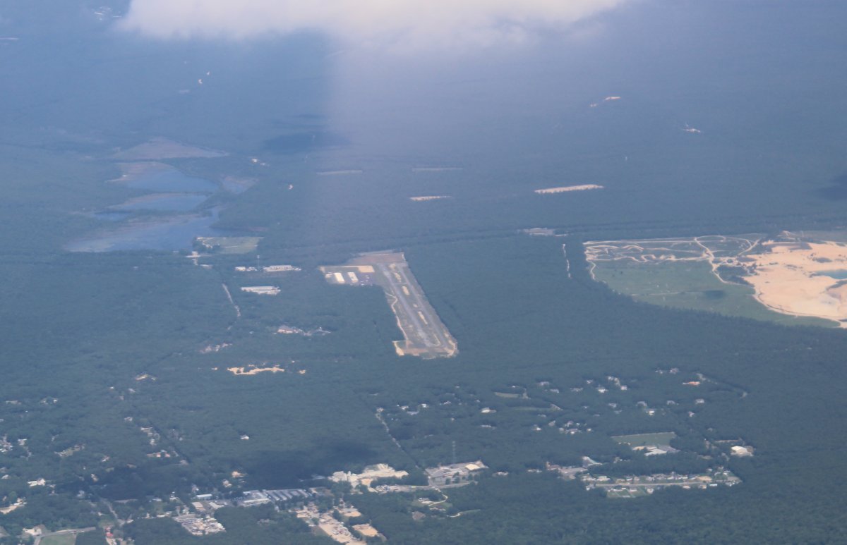
| Passing by Ocean County Airport (KMJX). The fuel prices are low here; I'll have to stop sometime. It's sort of by itself in a sea of trees; not what you normally think of you hear "New Jersey". |
| |
 |
|
|
I wondered what this was. It turns out it is Coyle Field Airport which is a private-use airport owned and used by the New Jersey Forest Fire Service. It has three 1,800 foot gravel runways.
|
| |
 |
|
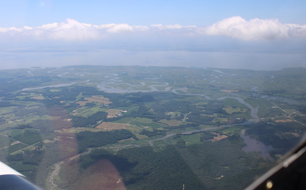
| Looking down from a high altitude at the marsh area I have flown over a lot in 2020. It's the Mad Horse Creek marsh on the east side of the Delaware River. |
| |
 |
|
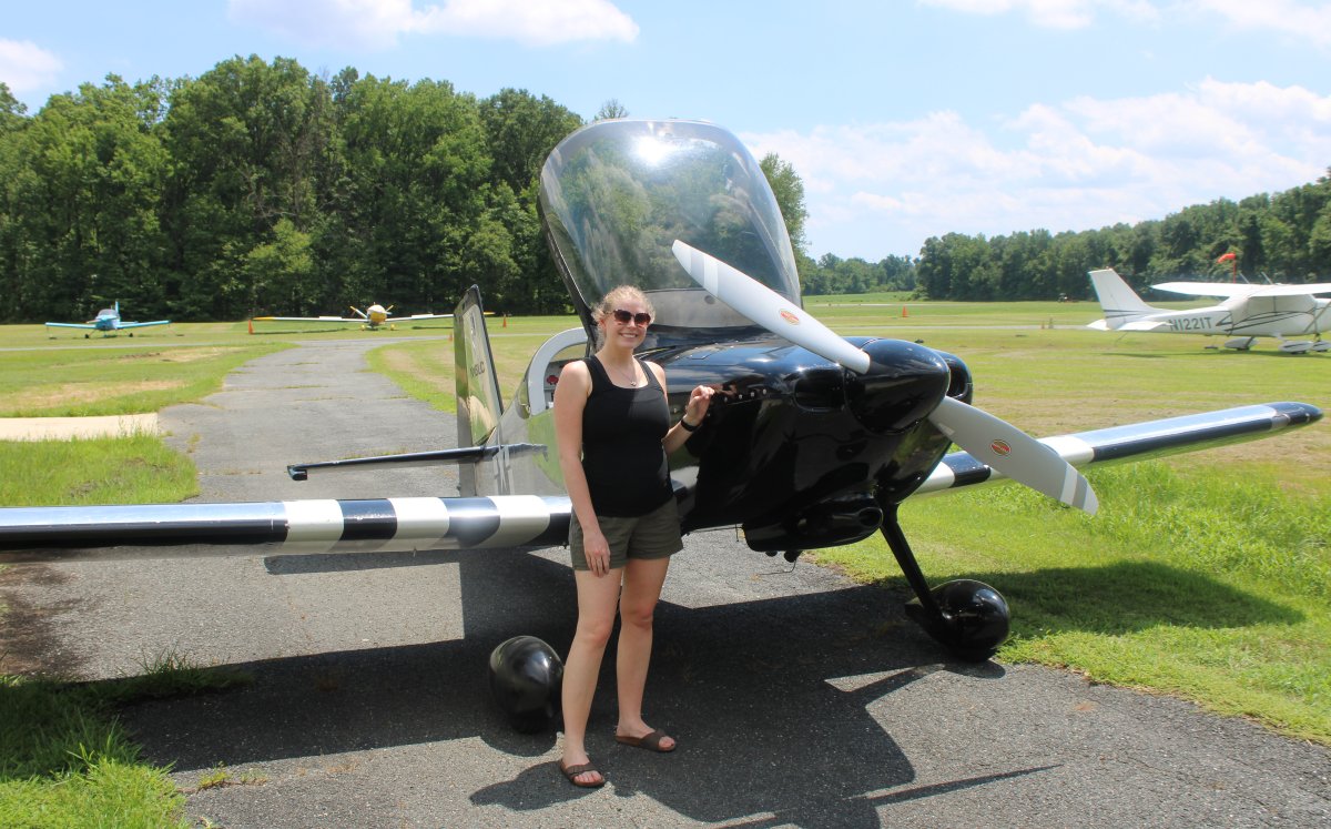
| Safe on deck. Maggie enjoyed the flight! |
| |
 |
|
| |
| |
|
|
|
|
|
|